Home | News | BRR | MMT | WHM | Search | Contact
Martin
Luther King Weekend VHTRC Runs
Massanutten Mountains
Friday prelude – VHTRC Moonlight Run
This 14 Mile warm-up for the MLK training run weekend is the annual VHTRC Moonlight Run, which is a night-time event without flashlights on the trails around Signal Knob. The run will start at 9pm from the Signal Knob parking area at the north end of the Fort Valley. For much more information, refer to the Moonlight Run event page.
MLK Training Weekend overview
The training runs on Saturday January 19th and Sunday January 20th will provide good, low-key, supported opportunities for trail runners of all levels of experience and ability to spend some time on the technical and mountainous trails in the Massanutten Mountains. They should also provide excellent training opportunities for those who are signed up to run the Massanutten Mountain Trail 100 Miler in May.
The Saturday Buzzards Rock to Camp Roosevelt course is a point-to-point run that does not provide for an easy way to cut the run short, so plan on going this full distance if you wish to participate. The Sunday Gap to Gap event will start and finish at the same point, and thus will offer several opportunities for runners to shorten the distance if so desired (or to add on some bonus miles as well, for that matter). Bear in mind that these runs will be held in the mountains in the middle of the winter – prepare accordingly! The Kerns Mountain ridge section and the Bird Knob section of the trails in particular, that will be encountered during the Gap to Gap run on Sunday, have been known to be iced over at this time of year.
The courses on Saturday and Sunday will NOT be marked with any ribbons – you will need to be able to follow the turn sheet directions and the blazes. Maps and turn sheets will NOT be provided. Each runner is responsible for bringing his or her own directional aids to the runs. And remember this is a training run and not a race, so finding someone else to run with, particularly if you are unsure of the course, may prove to be helpful!
Common aid will be provided at both runs, using items that you will be asked to bring with you. Personal aid can be stored in a drop bag and will be carried along the course for you each day if you so desire. An email will go out to those runners who have RSVP’d ahead of time letting you know what you should bring to add to the community aid at the start of the run. This aid will then be made available for all the runners at three aid stations on each day’s run.
Please contact Tom Corris (tcorris@comcast.net) if you plan to come out for the Saturday run from Buzzards Rock to Camp Roosevelt. Please contact Quatro Hubbard (quatro.hubbard@gmail.com) and Mike Bur (mjcbur@yahoo.com) if you plan to join us on Sunday for the Gap to Gap run.
Saturday – Buzzards Rock to Camp Roosevelt MMT Training Run

Tom Corris
The 31 Mile training run from Buzzards Rock to Camp Roosevelt will be held on Saturday January 19th. It will be directed by Tom Corris (tcorris@comcast.net). The course will generally follow the eastern ridge of the Massanutten Mountain range. The run covers the early third of the Massanutten Mountain Trail 100 miler course, starting at the trailhead at Buzzards Rock that serves as the first aid station during MMT, and ending in the parking lot at Camp Roosevelt. This parking lot is very close to the area used for the Camp Roosevelt aid station at mile 33.3 during MMT.
Everyone should drive to Camp Roosevelt before 7am so that runners can work out carpool arrangements and be ready to drive up the Fort Valley to the start. This drive takes roughly 30-40 minutes, so we should be able to get on the trail by 8am. Those designated carpool drivers transporting others to Buzzards Rock should remember to leave a drop bag in someone else’s vehicle at Camp Roosevelt so that you will have a change of clothes ready there – it would also be good to include in that drop bag something refreshing to enjoy around the post-run campfire. Drive the biggest passenger vehicle you have at your disposal to Camp Roosevelt, so that we can more easily carpool everyone over to the rather small parking lot at the Buzzards Rock trailhead. Do NOT drive directly to Buzzards Rock – in order for this system to work, we need to have everyone gather at Camp Roosevelt first!
You can find the MMT turn sheet on the MMT web site – we will be running on Saturday from Aid Station#1 to Aid Station#6. The trails are also shown on the Potomac Appalachian Trail Club’s Map "G" (Massanutten Mountain-North Half).
We will be asking each runner to bring one item for common aid on Saturday and another item if you plan to run again on Sunday (a gallon of water, large bottle of Gatorade or soda, can of Pringles, bag of cookies or chips, etc). These items will be ferried around the course for your use at THREE aid stations. If there is some special food or drink items that you personally will need to get you through this run, then you can put them in a small, sturdy, well-marked drop bag that will be driven around the course for you.
Directions to Camp Roosevelt:

That's our Tom!
Drive to Luray, using whatever route is easiest for you to follow. Off of the Route 211 Bypass you will take Route 340 Business south into Luray. Take the first right off 340 Business on to Mechanic Street (Route 675) – this road is not very obvious, so stay alert for it. Mechanic Street will become Bixlers Ferry Road after you cross back over the Route 211 bypass, but it will still be Route 675. Continue on Bixlers Ferry Road until you cross over the Shenandoah River (about 4.5 miles after your turn off of Route 340). Go left, which will keep you on Route 675, and then take your first right, again still on Route 675 (now Fort Valley Road). This will take you over the mountain ridge down towards Fort Valley. Look for a dirt road (about 1.5 mile down from the ridge) that will branch off at an acute angle to your right as the paved road veers to the left – this is the very inconspicuous entrance to the Camp Roosevelt parking lot. If you see wooden signs for Camp Roosevelt and Massanutten trail head, you have just missed the dirt road entrance to the parking lot.
If you plug in “Camp Roosevelt, VA” into Google maps, you can get additional directional aid.
Description:
Start: Follow white blaze on Buzzard Rock Trail for 3.9 miles to Shawl Gap, with orange, yellow and blue blazes at the gap. Turn left and run downhill on yellow Shawl Gap trail. Be alert as you begin this descent on yellow so as not to miss the right turn after 0.5 mile. Continue 1.9 miles on yellow to what is the Shawl Gap aid station during MMT (AS #2) – this will be the location of the first community aid station during this training run. Turn right at the end of the trail onto Route 613 (dirt) and run 3.1 miles to Veach Gap Trailhead – this will be the second aid station during the training run, and is the Veach Gap aid station during MMT (AS #3). Go up Veach Gap trail following blue blazes for 1.7 miles. Turn left at the ridge on orange Massanutten Trail. Run 4.8 miles on orange to junction with purple Indian Grave Ridge trail. Turn left on purple and run down 2.5 miles to dirt road. Turn right on this road (Route 717) and run 2.9 miles to Route 684. Bear right at this junction, and continue on road for 1.0 mile to Habron Gap trail head. This will be the third and final aid station on the training run (AS #5 at MMT). From here you will climb (and climb) on blue blazed Habron Gap trail for 2.1 miles. Turn left at ridge on orange Massanutten trail. Run 2.7 miles to start of yellow blazed Stephens Trail. Turn right on yellow and head downhill for about 4.7 miles to the parking lot at Camp Roosevelt and the finish of the training run.
Sunday – Gap Creek I to Gap Creek II MMT Training Run

Mike Bur
This 26 Mile training run is in the Crisman Hollow/Kerns Mountain/Bird Knob area of the George Washington National Forest between New Market and Luray. This run will be overseen by Quatro Hubbard and Mike Bur.
The Gap Creek I to Gap Creek II training run will be held on Sunday January 20th. Runners should gather at the Gap Creek trail junction with Crisman Hollow Road (FDR 274) in time for the start of the run at 8am. Parking can be a little tight in that area, so carpooling is highly encouraged. Runners might also want to coordinate with each other to meet up in the Visitor Center parking lot and carpool down Crisman Hollow Road from there.
The
description of the Gap to Gap run may be viewed below and a variation
of this description is also available on the MMT web site
- Aid Station #7 to Aid Station #11). The trails are also shown on
the Potomac Appalachian Trail Club’s Map "G"
(Massanutten Mountain-North Half) and Map “H”
(Massanutten Mountain-South Half).
Six miles into the run there
will be an aid station at the Crisman Hollow Road crossing after
coming off of Kerns Mountain. There will be one full aid station in
the Route 211 East parking lot, which the runners who do the
Massanutten South section will pass through twice (at the 9.1 and
19.3 mile points on the course). You will be asked to bring a food
or drink item for the common aid used at these aid stations. Again,
if you want some particular food or drink items during the run, you
can put them in a small, sturdy, well-marked drop bag that
will be driven around the course for you.

Quatro
Runners may also plan for the traditional post-run dinner at Dan’s Steakhouse near the 211 East parking lot prior to leaving the Massanuttens late Sunday afternoon.
Directions to Gap Creek:
From the DC Beltway (I-495) take 1-66 West to I-81 South. Exit in New Market on Route 211 East. Follow US 211 east towards Luray for approximately 6 miles to the New Market Gap in the Massanutten Mountains. At the top of the gap, just prior to reaching the Visitor Center, look for a road off to the left - FDR 274, Crisman Hollow Road. Follow Crisman Hollow Road for several miles down to the marked junction with the Gap Creek trail. Parking spaces are available along the side of the road. Or you can follow the directions to Camp Roosevelt as described above, only continue past Camp Roosevelt to the bottom of the hill, go left at the road junction on Crisman Hollow Road, and continue to Gap Creek trail crossing after a couple of miles.
Description
Start: Leave the area near where the Gap Creek aid station will be during MMT (AS #7). Cross FDR 274 (Crisman Hollow Road) and take blue Jawbone Gap Trail for 1.2 mile climb to saddle at ridge. Turn left on orange Massanutten Trail for 4.8 rocky & rolling miles (Kerns Mountain), exiting trail Crisman Hollow Road crossing (6 miles to this point). This will be the location of the first aid station on the training run, and is the site of an unmanned water station during MMT. Cross the road and continue on Massanutten Trail (orange). This is the old Waterfall mountain trail section. The trail starts level but then descends steeply after 0.7 mile. From the top of the descent, you go 0.6 mile to the Massanutten Connector Trail. Turn right on the white Massanutten Connector Trail. This trail turns right onto a road, FDR 415, after a 0.7 mile climb. Follow this road down for 1.1 miles until it ends at Route 211. Cross 211 (carefully!) to the 211 East aid station in the parking lot on the other side (9.1 miles to this point). This is AS #8 during MMT.
Leave the parking lot on the orange Massanutten Mountain South trail (MS) for 1.7 miles to a parking lot/picnic area. Stay to the left and pick up a pea gravel trail on the other side – this trail will go up to the left. Go 0.2 mile to intersection with orange MS trail (there should be a bench here). Turn left on orange MS and go for 1.9 miles (mostly uphill) to the intersection with the white blazed Bird Knob trail. Do NOT take the Bird Knob Trail. Instead, go left on the orange MS and go 1.3 miles (on the “Ant Road”) to a locked gate on a dirt road (during MMT there will be an aid station here – AS #9 – for this training run, there will not be aid here).
Turn around and leave the way you came in on the orange blazed MS. Follow it back exactly the way you came to 211 East aid station in the parking lot (19.3 miles to this point). This is the third aid station of the training run, and AS #10 during MMT.
Leave 211 East aid station, cross back over Route 211 (again, carefully!) and re-trace your earlier steps up the Massanutten Connector Trail (white). Go 1.1 miles on road (FDR 415), then left onto single-track trail (white). In another 0.7 miles, you will be back at the intersection of the Massanutten Connector trail (white) and the Massanutten Trail (orange) at the bottom of Waterfall where you were earlier. DO NOT GO LEFT up Waterfall. You want to go right on the Massanutten Trail (orange). You will climb 2.0 miles to the intersection with the Scothorn Gap Trail (yellow). At this point the MT (orange) trail goes up to the right and the Scothorn Gap Trail (yellow) goes to the left and also goes straight. Continue straight on the yellow Scothorn Gap Trail, NOT left as we did in years past. You will be on the Scothorn Gap (yellow) trail for 1.7 miles until it ends at the (blue) Gap Creek Trail. Go left and down on the (blue) Gap Creek Trail for 1.3 miles to Gap Creek aid station (AS #11 during MMT) and the finish of the training run (26.1 miles total distance).
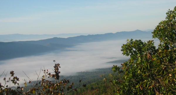
The Massanuttens and Fort Valley from Maneka Peak
Not in Winter!
Home | News | Events | About the VHTRC | Members Only | Features
Bull Run Run 50 | Massanutten Mt. Trails 100 | Training Runs | Links
Feedback